Showing posts with label Islands and Islets. Show all posts

Monday, 11 April 2022

RSPB Boyton Marshes and (views of) Havergate Island


We decided to revisit RSPB Boyton Marshes yesterday afternoon, a Suffolk nature reserve we have been to once, or at most twice, in the past. We had hardly left the farm, the cattle and the car park behind when we saw Avocets. We have watched these elegant birds a few times over here in East Anglia (and have even seen chicks at WWT Welney); but when I was a teenager in Norfolk, they were fighting for survival. Many of you will recognise the Avocet from the RSPB logo. 

We saw some other beautiful birds on the reserve: Mute Swans, Teal, Curlew, Grey Heron and Marsh Harrier, to name but a few. We also had good views across to Havergate, Suffolk's only island. You can see the western end of the island in the photo below (you can click on the photo to enlarge it), with the spit of Orford Ness on the horizon in the far distance. 

I love islands and was thrilled to locate this one. It is run by the RSPB for the benefit of wildlife. Visitors arrive on boats from Orford, bringing their own refreshments as there are no food or drink outlets. There are, however, a few hides to facilitate bird-watching activities.


The tidal flats on the salt marsh began to fill up as the tide turned during the afternoon. 


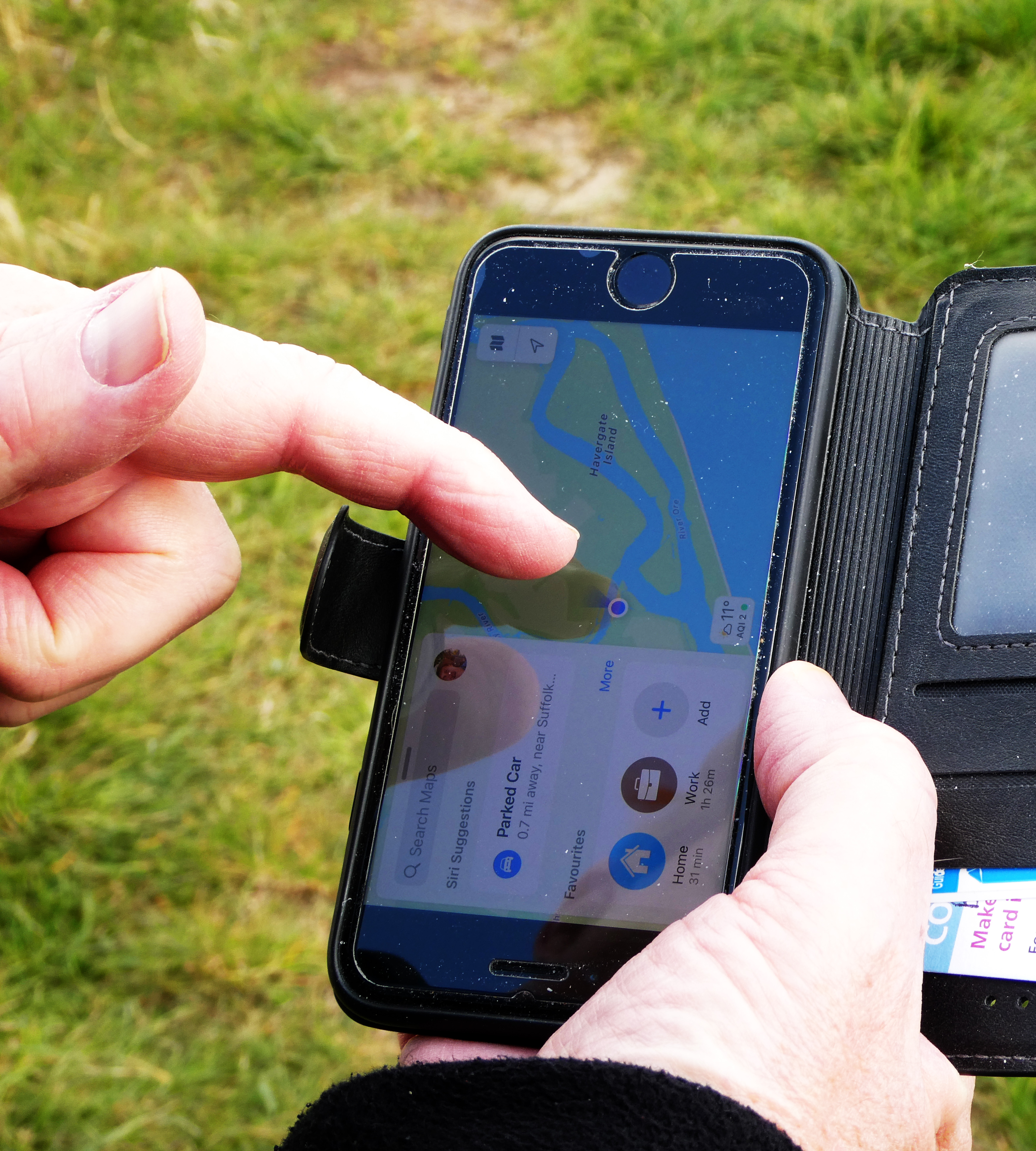
David was able to show me how the island nestles behind the spit of Orford Ness, the green strip on the right in the map on his iPhone screen.


You can see one of the hides in the photo above. This was taken with my zoom lens extended in strange shadowy light. We had a mix of sun, showers and even a couple of hailstones. I hadn't even noticed this particular Curlew when I took the photograph.

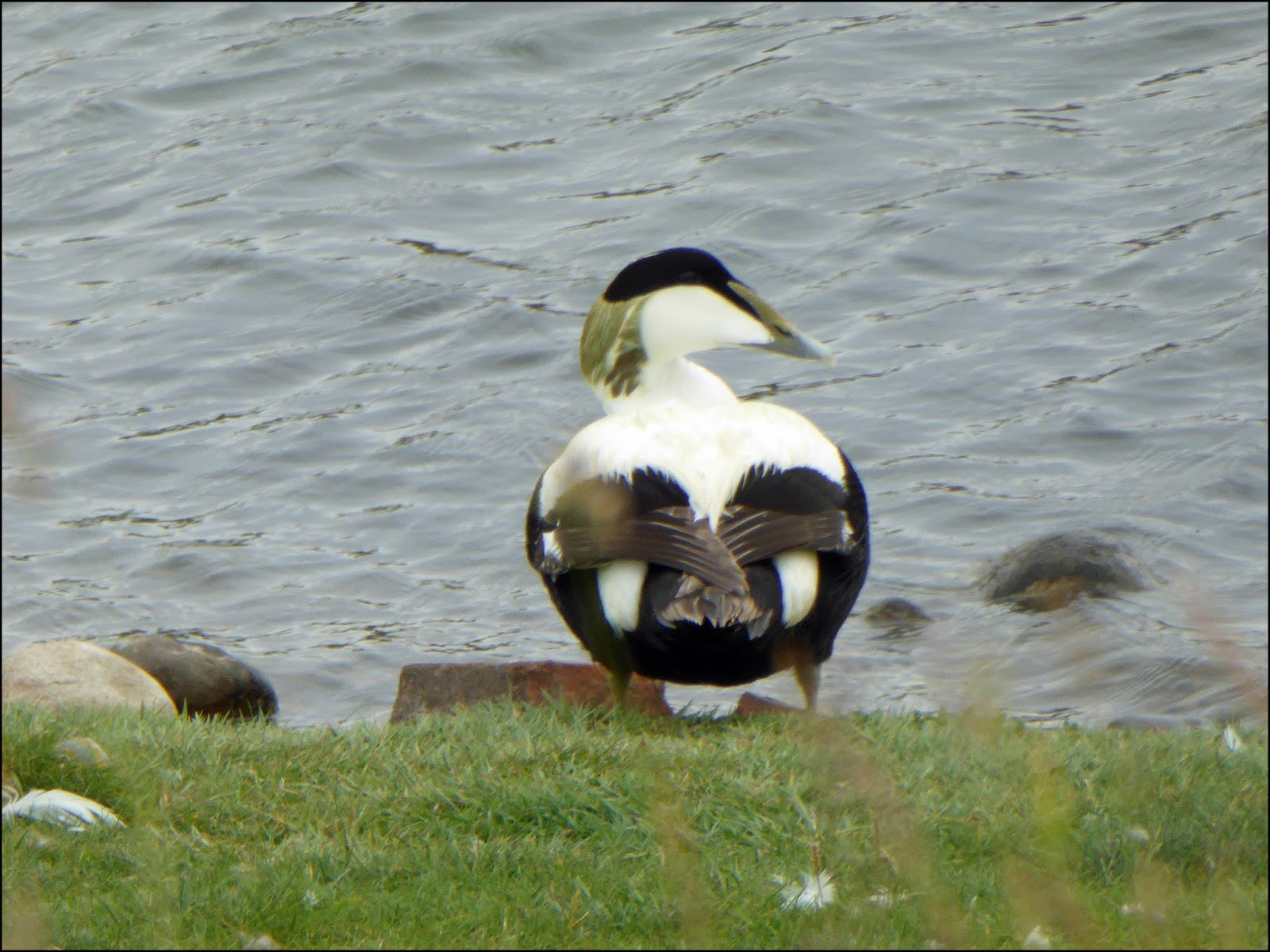
We were delighted to see a variety of ducks on the mainland reserve. These were near the Avocets. The ducks we saw included the Shelduck, ...


 ... the Eurasian Teal (a female in this case,
with her vibrant green streak) ...


... and the Shoveler.


During the course of the afternoon we encountered several Grey Heron.  


You can see from the next photo why it is such an ideal landscape for ducks.


The area around Boyton Marshes is very varied, which means there are a number of different habitats within and around the reserve. I noted the following (and our total of 15 species of bird sightings, counted in about an hour in a casual kind of way):

  • inland ponds (Teal, Shoveler, Shelduck, Avocets, geese)
  • farmyard with cows and bushes (Chaffinch, Carrion Crows)
  • reedbeds (where we could hear birdsong. A group of birders had their scopes trained on these)
  • estuary, Butley Creek (Curlew, Little Egret, Redshank) 
  • grassy sea wall (Marsh Harrier overhead, Oystercatcher at base)
  • fields, ?water meadows (a flock of Mute Swans, Greylag Geese, Canada Geese, Lapwing)
  • island, Havergate Island (gulls on roof of a hide, though I couldn't see which)
  • shingle spit, Orford Ness - too far out to see specific species
  • North Sea - too far out to see specific species


The photo above shows the grassy bank to the right. On the left you can see that there are reedbeds and a watercourse receding into the distance. Butley Creek, a tributary of the river Ore (as in Orford), can be seen from the top of the bank, as shown in the next photo.


The ruined building above constitutes the scant remains of Boyton Dock. For a fairly short period in the mid-seventeenth century, substantial amounts of 'potter's clay' were loaded on to ships from this part of the estuary. Some of the clay was used in America and the Netherlands while some was used in the London Delftware industry. The mid-nineteenth century saw Boyton sending coprolite to Ipswich by barge for the manufacture of fertiliser. I spent a year of my life in Ipswich as a resident of Coprolite Street.

There are, in fact, several ruined buildings in this part of Boyton and its environs, many linked to defensive measures. The name 'Boyton' stems from 'Bay Town', the bay being nearby Hollesley. Boyton was one of the Suffolk locations picked for the filming of The Dig

The photo below shows the view from the Dock, with some of the more distant ruins on the eerie spit of Orford Ness beyond the far bank (and over the water, which it hides). 


I felt a few hailstones on my face as this Marsh Harrier flew high above our heads ...


We took a final look at Havergate Island and turned for home. 


Our view of the creek once we had turned round.


Monday, 30 April 2018

Isle of Wight (5): Rainbow Sand at Alum Bay


According to the local Isle of Wight forecast, the Monday before Easter was due to be the brightest day of the week, so we headed off to see the famous coloured sands of Alum Bay. 

As a youngster I was very interested in stones and fossils. Our holidays were largely spent on The Lizard in Cornwall, with its wonderfully rich shades of serpentine. I remember being very excited on one occasion when I thought I had discovered samples of a rare mineral in among the grains of sand on the beach at Kennack: these turned out to be spines that had come adrift from the test or exoskeleton of sea urchins. They may have been 'animal' rather than 'mineral', but they were fascinating all the same. 

Friends and family members have visited Alum Bay over the years, but I was keen to see the cliffs for myself. I wasn't so sure about the chairlift, but what a lot of fun it proved to be. 


What a view... and with the Needles in the background.


But what a long way down!


All too soon we were on the beach in glorious sunshine.


I came across these sandcastles, and felt they demonstrated three shades of the coloured sand to perfection. I had not imagined that it would be possible to separate the colours in this way without the use of some kind of equipment.


We had only to turn our backs on the sea to notice these stratifications of colour.


My eyes alighted on the small red outcrop of sandy rock in the photo below. It looked volcanic and hardly seemed real.


This website is packed with pictures, tables and photos about the minerals of Alum Bay. It explains the different colours and their mineral formations.

I am no geologist, but my understanding is that the red sand above comprises Pyrite (Ferrous sulphide) that has been oxidised in the cliffs. The other colours in the cliffs are due to ...
  • organic lignite layers
  • clays (e.g. London Clay which is a grey-brown shade)
  • sands (e.g. the yellow and brown sand colours which are due to limonite, a form of oxidised iron).
  • glauconite (a mineral which accounts for tints of green and is a complex silicate of iron, potassium and aluminium)
And, of course, as you round the bay towards the Needles, you encounter the stark whiteness of chalk.

There is a helpful section on the colours in this pdf.


We had a lovely time on the beach. A quick glance at this photo above with its rocks and pebbles shows immediately that there is a mix of mineral material.


The tide had receded while we were on the sands, revealing one or two rock pools like the one in the photo above. Sadly the seaweed was too slippery to allow me a close look.


The coast around the island seemed rich in shells. The photo above shows a small corner of rock on the beach at Alum Bay, housing a Limpet, a yellow-coloured Dog Whelk, Nucella lapillus (these come in various shades), and at least five other molluscs.


Limpets and barnacles were well represented, too.


The pebbles were beautiful, particularly those on the tideline, washed by the waves. I haven't been able to identify the one above.


These strands of red seaweed complemented the pebble above.


We watched a helicopter as it flew over the Needles. The photo above shows David peering out to sea. What a lovely empty stretch of beach!


Not surprisingly the coloured sands of Alum Bay have been popular for a long time. The first known mention is from 1780. Queen Victoria was apparently presented with sand gifts from Alum Bay in 1860, and this started a trend. Victorians were particularly fond of sand souvenirs and these took many forms: we noticed the bell-shaped ornament below in the museum at Carisbrooke Castle. Tourists in times gone by could purchase a painterly picture, or marmotinto, crafted from sand: they could also buy small packets of sand with which to create their own.


These days, of course, green issues and conservation initiatives are much more prevalent. Sir David Attenborough's 'Blue Planet' series has made many of us more conscious of the fact that unhelpful human behaviour can cause devastation to the wildlife in our oceans, with the haphazard and hazardous distribution of plastic as a particularly alarming issue. I was amazed to discover that the National Trust's Neptune Coastal campaign has now been running for over 50 years.

Incidentally, and speaking of the coast around Britain, if you would be interested in a vibrant new poetry book linked to the Marine Conservation Society's 'Thirty Threatened Species' 30th anniversary project, I would point you in the direction of Susan Richardson's sparkling and punch-packing 2018 collection, Words the Turtle Taught Me, published by Cinnamon Press.

At one time there were 21 different shades of sand at Alum Bay. I am glad to say that the collection of sand from the beach by the general public is forbidden. Climbing on the cliffs is not allowed.

Sand is still available in the shop above for the creation or purchase of souvenirs. These days the coloured sand is taken at the end of the season exclusively from piles that have fallen from the cliffs.


Our visit coincided with a cold but still morning. Suddenly something caught my attention as I stood with my boots on the edge of the shore, keeping a look-out for the ninth wave. I turned round to see a mini sand/landslide on the cliffs behind. The photo above shows the results of this activity. What a beautiful but fragile environment.


This view above shows the proximity of the Needles to the beach of many colours.


The lighthouse was built in 1859 and the last keeper left in 1994. Its predecessor was constructed high above Scratchell's Bay, where it often disappeared in clouds of mist.


1987 saw the creation of a helipad on top of the lighthouse. 


If the lighthouse provided one kind of communication, the wireless telegraph station provided another.


Meanwhile, back on the beach, I was thankful that the chairlift was working so that these steps were not the only way up from the sands!


As you can see, the photos immediately above and below were taken from the adjacent down. They show not only the colours but also the fact that early geological activity left the different bands of rock strata almost up on end.


Further along, just beyond the chair lift, there were places where horizontal stratifications could be seen ...

There were a good number of rabbits grazing up on the chalky down near the Old and New Batteries.


We stood at the Needles viewpoint, looking back at the beach. In contrast to the warm sandy reds and yellows, the cliff here was a mass of cold white chalk which reminded me in some ways of an iceberg.


It had been a fascinating and educational experience. David tried out a couple of selfies before we left to find a much needed cup of tea.


My next post will probably be my penultimate one in this series on the Isle of Wight. I hope to highlight a couple of gardens and the Newtown Nature Reserve.

Saturday, 16 July 2016

Holiday 3: A Day on Walney Island


I had read that there was a Cumbrian Wildlife Trust nature reserve at South Walney, so after we had visited the ruins of Furness Abbey, we drove through Barrow and over the bridge in the photo above to Walney Island (which is the near side in the picture). It was a rather chilly day in June, and my photos testify to the fact that the sun was not much in evidence.


The island is not very large and we were soon on the reserve. I was thrilled to find Eider ducks in good numbers, including the pair in the photo above.


I gather that Walney Island pretty much marks the southern limit of Eider colonies on the west coast. Eiders are amber listed in terms of conservation, so the island is lucky to be able to boast 700 breeding pairs. The duck in the photo above is the female ...


... and this one is the male.


There are long expanses of shingle which provides a nesting area for various gulls, terns and other species such as the Ringed Plover. The Horned Poppy added a splash of sunshine to the scene.


Can you spot the Eider ducks nestling on the grass of the remains of the Walney Salt Works, which closed in 1909?


The lighthouse dominates the skyline.


Piel Castle lies across the water, and can be reached by boat. In 1487 Lambert Simnel landed on Piel Island. The castle dates from the 14th century.


The photo above shows the Eider colony on Walney Island.


In addition to long shingle beaches, there are large areas of saltmarsh.


The photo below helps to give a sense of scale and also a sense of 'the remote', which is something that strikes the visitor after the hustle and bustle of Barrow.


In a landscape that was predominantly grey, it was not only the Horned Poppy but also the tall spikes of Viper's Bugloss that added colour to the scene. We thoroughly enjoyed our visit, but all too soon we were crossing the bridge back to the mainland for a drive through the Lakes to our rented holiday property near Cockermouth.